
Rosewill Valley Catchment Group
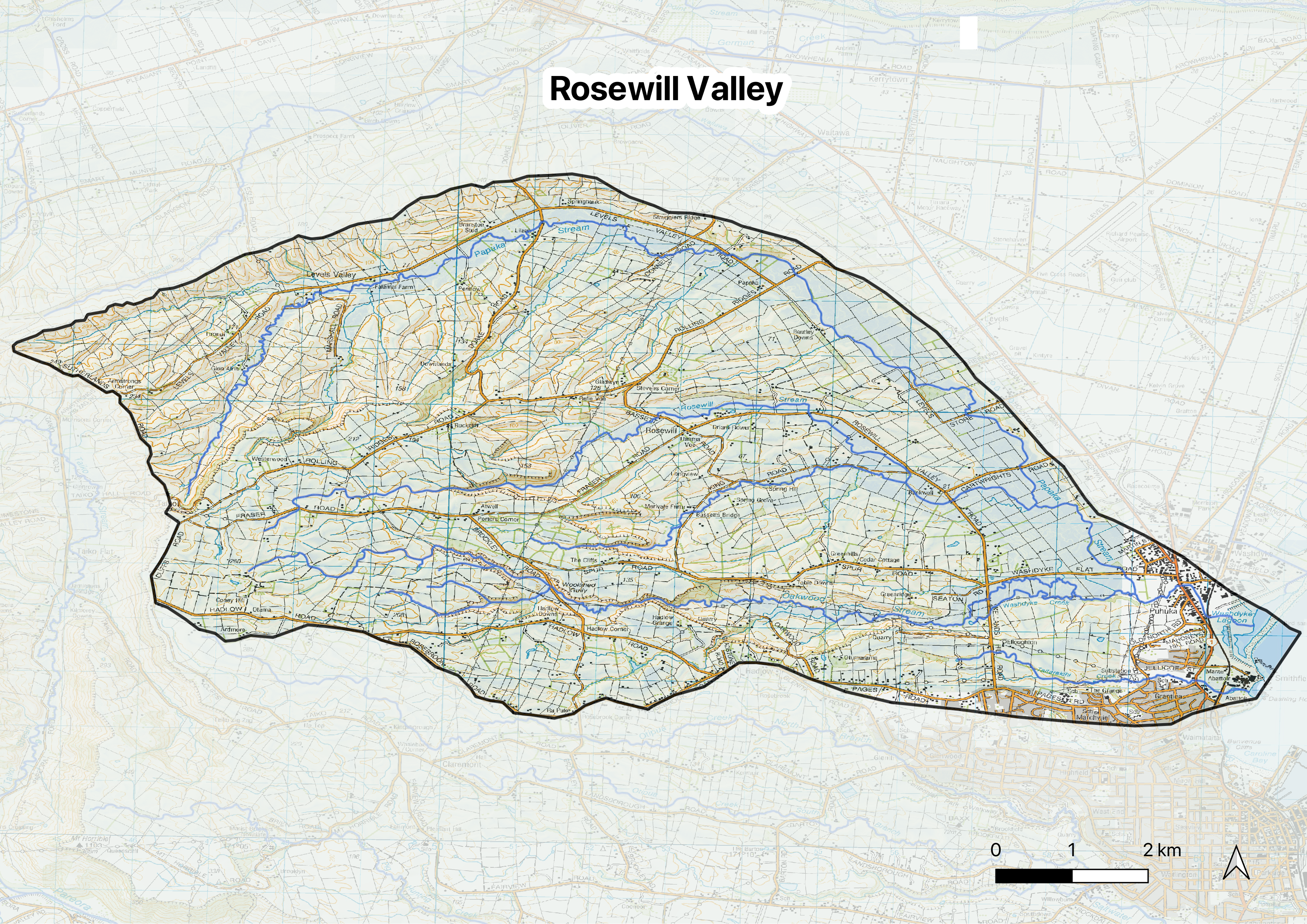
Rosewill Valley Catchment Group is situated on the rolling downland landscape immediately inland of Timaru. It is home to one of the region's most culturally and ecologically significant places: Waitarakao (Washdyke Lagoon). This traditional mahinga kai area is one of the last remnants of a once-extensive network of coastal wetlands between the Rangitata and Waitaki Rivers. The catchment group are participants in the Our Waitarakao Project.

Rosewill Valley Field Day
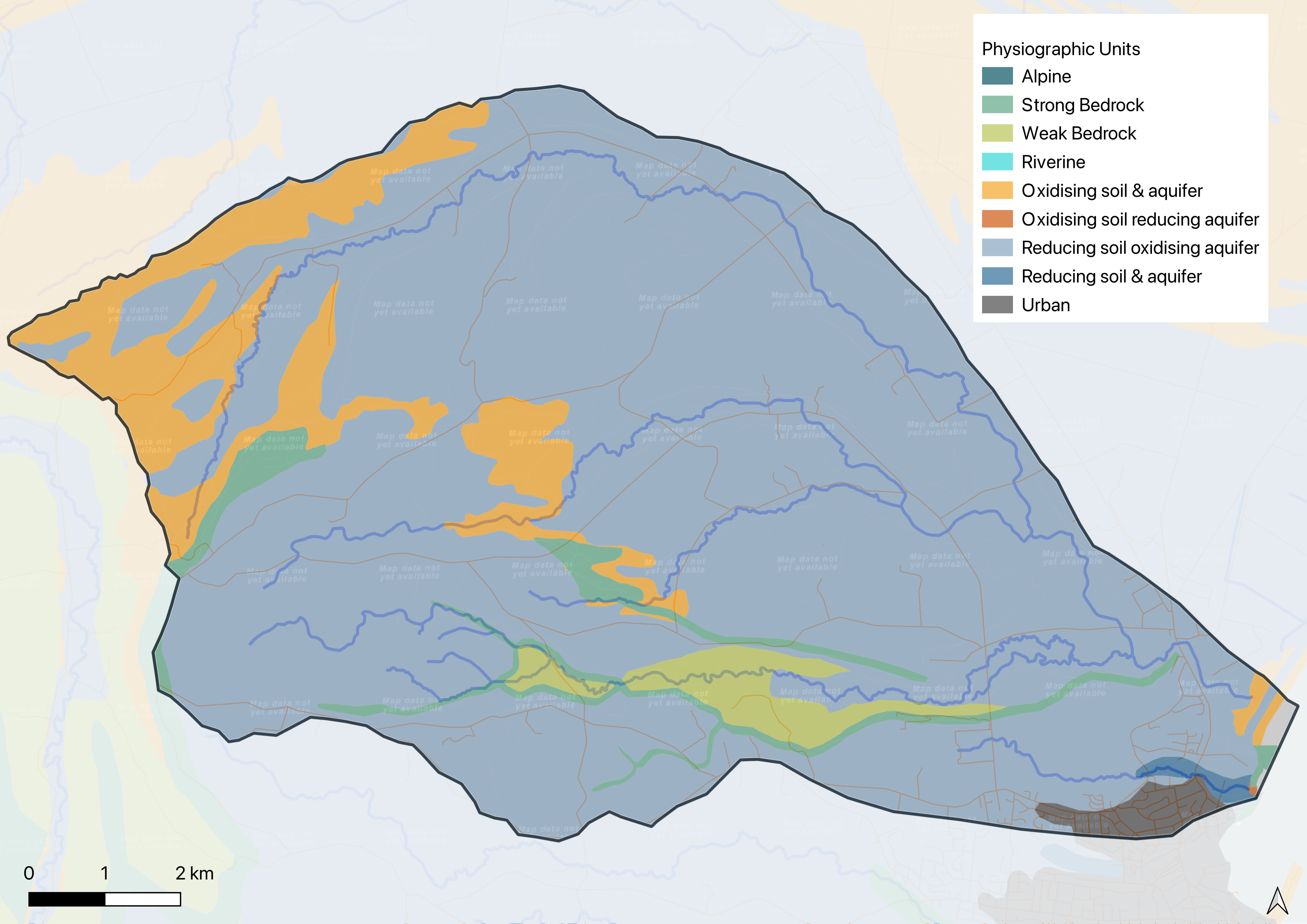
The catchment's story is shaped by history. Aerial photos from the 1930s show complete vegetation removal, and intensive farming has continued for over a century. Understanding their unique geology, through the physiographic approach, has been transformative for this group. The heavy clay soils naturally remove nitrates, which means the focus can be on other things, like soil health and keeping sediment on the land.

Sediment detention bund
Much of the opportunity is about healing the legacy of the past, restoring and enhancing habitat, while managing a farmed landscape that's naturally prone to sediment runoff, especially during the wettest days of winter. Since so much of what needs to be done is about active management of inherent opportunities in the landscape, relationship building and outreach will be very important to long term success.
Restoring trust in the regulatory process will be a key task if the group is to move forward. In the past, farmers who took positive environmental action have sometimes found themselves disadvantaged when seeking consents later. We will need better integrated solutions in future because so much of the opportunity to reduce impact involves proactive efforts by people on the land, which are difficult and inefficient to force through regulation.