
Upper Opihi-Opuha Catchment Group
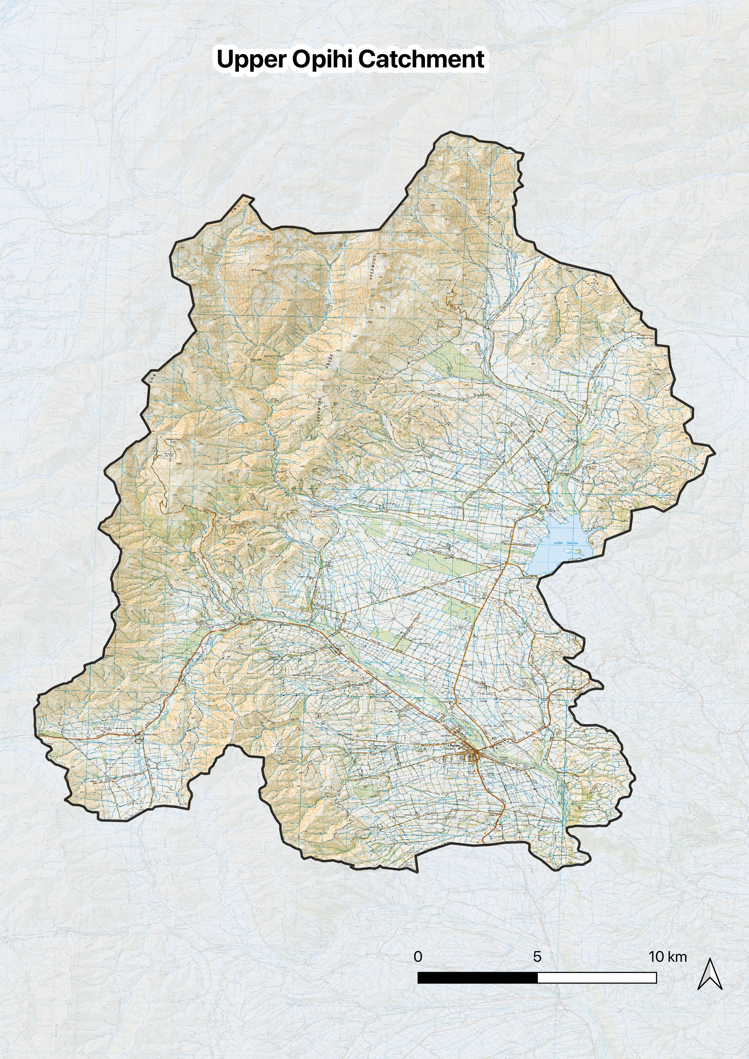
Fairlie Basin is a very special place; both in terms of its tight and well connected community, and a unique geology which creates a geological context for elevated nitrates in groundwater and local streams.
The Upper Opihi-Opuha Catchment Group is committed to getting to the bottom of drivers of high nitrates and developing workable solutions for continued farming in the basin. They have embraced support from Opuha Water Limited (OWL), DairyNZ, and Living Landscapes, to bring cutting edge science to better understand why nitrates are high, and also the wider perspective of stream health.
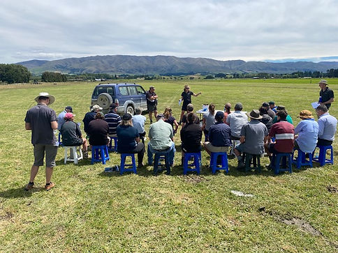
Field day in Strathconan Stream

Presentation from Julia Crossman at Opuha Water Limited
Elevated Nitrates
Fairlie Basin was mapped as a “high nitrate concentration area” in Plan Change 7 (PC7) of the Canterbury Land and Water Regional Plan.
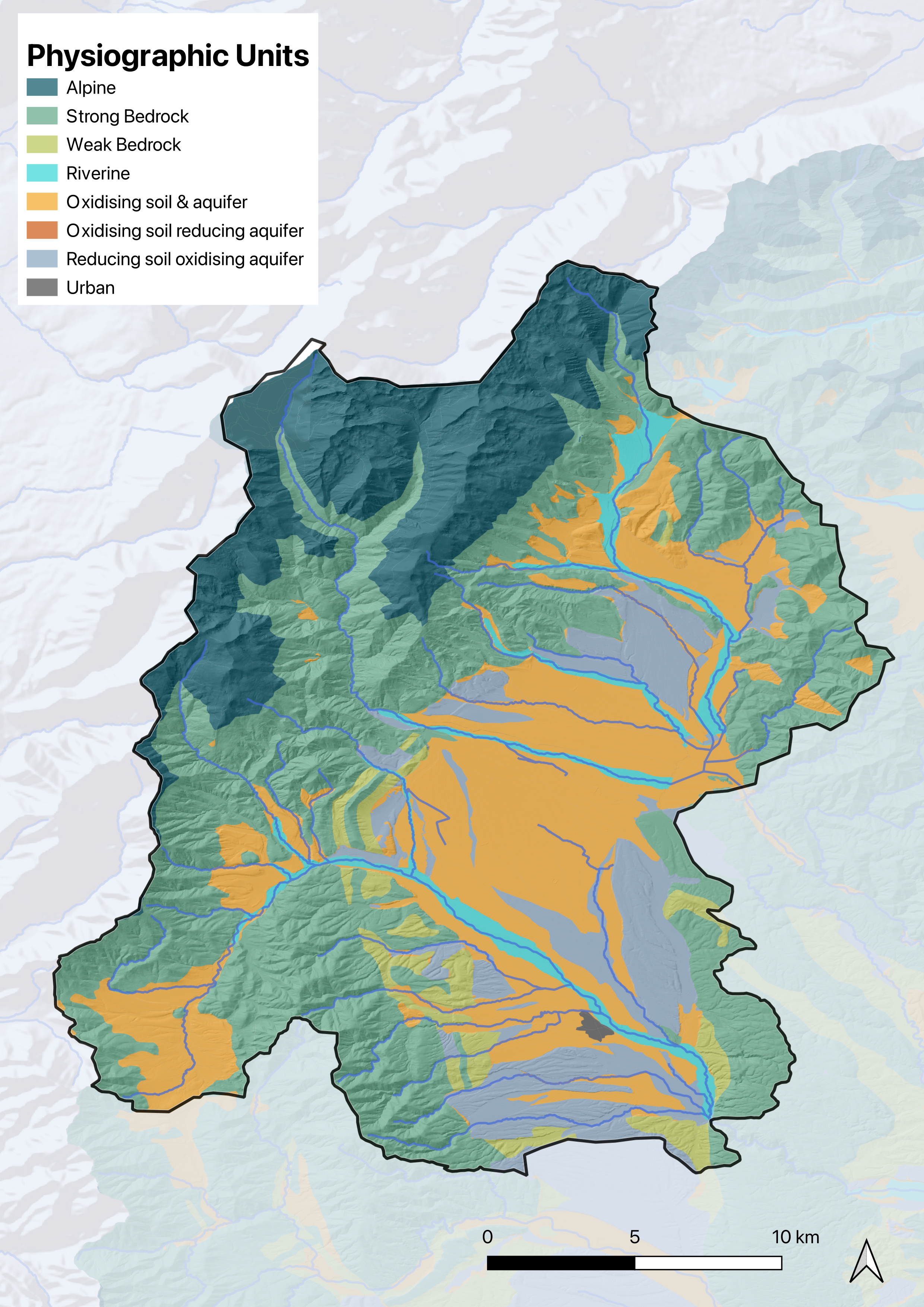
By applying the physiographic approach we have learned how soil and landscape factors create the context for water quality. The geology of the basin consists of a thin gravel aquifer and shallow water table, sitting on a ‘shelf’ of impervious rock. Groundwater is therefore confined close to the surface, making it more difficult to control the impact of nitrate loss from farming.
Since 2023 an intensive programme of nitrate monitoring has been undertaken in partnership with OWL and DairyNZ to gain more information about the problem. As monitoring continues, the Catchment Group will be able to learn more about the problem and how they might be acknowledged as part of the solution.
Impact Assessment for Glenfield Stream
Glenfield Stream is one of the main spring fed creeks draining the area with high-nitrate groundwater.
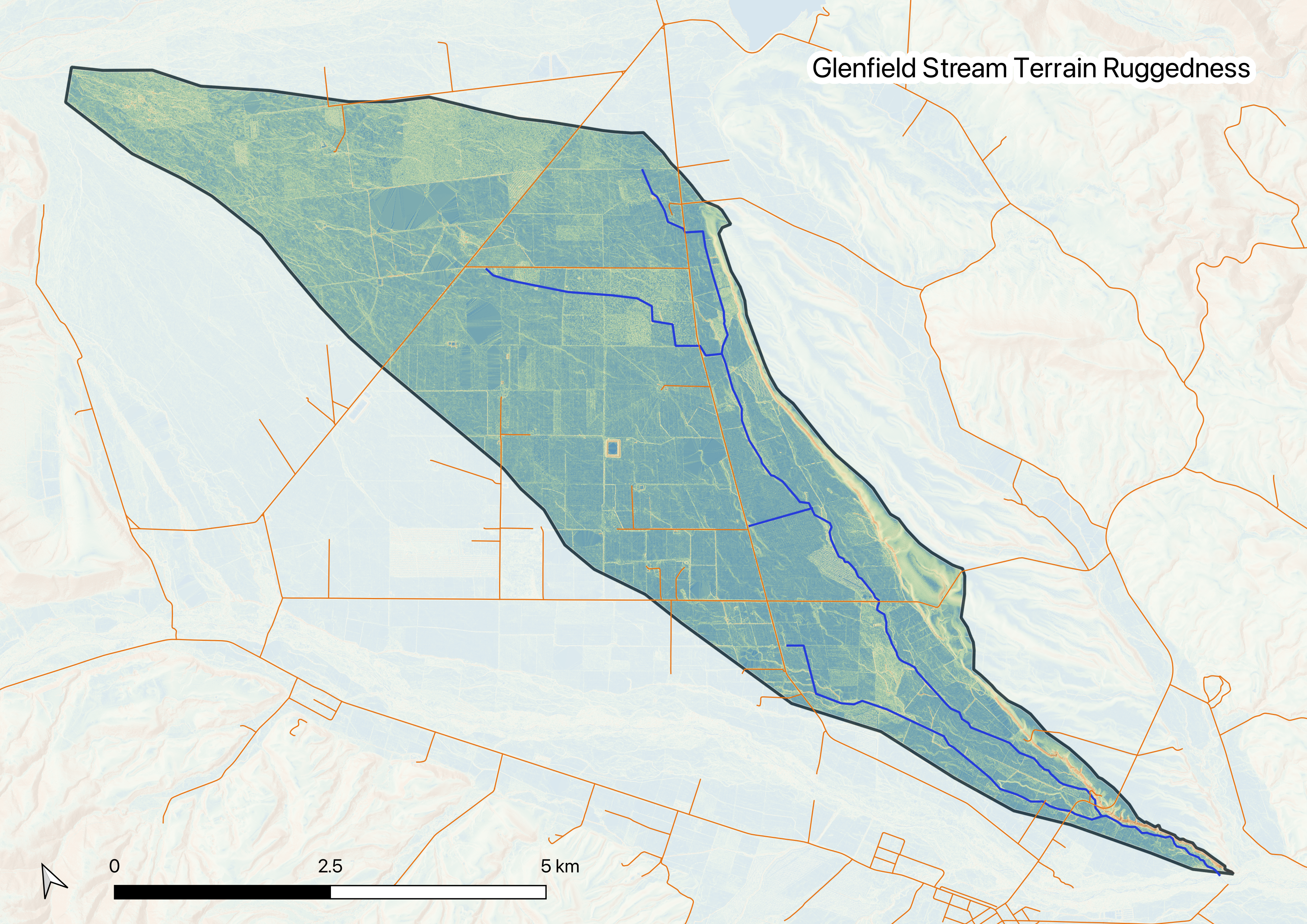
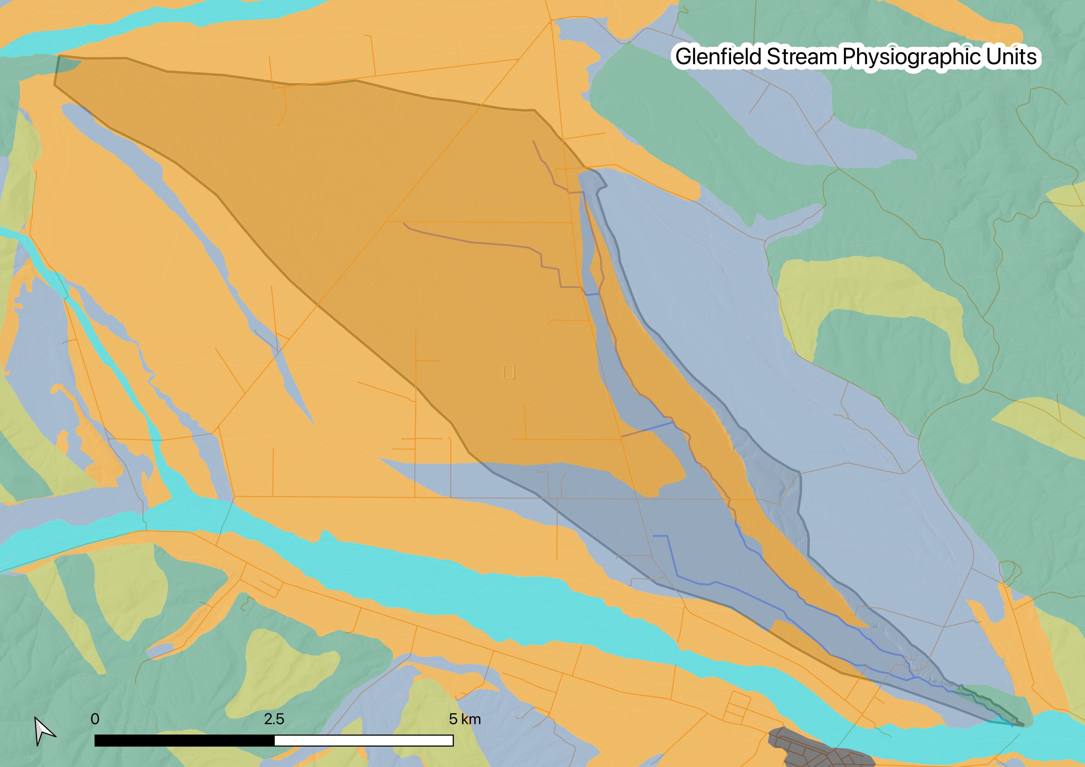
The recent eDNA Survey gave us a better picture of stream health, and the presence of rare aquatic species across the basin. We know that Glenfield is in ‘good’ condition and home to rare species such as kakahi (freshwater mussels).
We also know that there are substantial opportunities to improve stream health by rectifying impacts, for example:
-
Simple low-cost interventions to rectify historic diversions to bypass or drain wetlands.
-
Planting large tussocks and small shrubs to shade the stream.
-
Keeping the area free of invasive willows (both a threat and an opportunity now that stock are excluded.
The catchment group wants to know how effective these types of actions will be, compared to the (much more challenging) task of reducing nitrate losses ‘beyond good management practice’ in an inherently challenging setting. To this end, a formal impact assessment will be undertaken in the summer of 2025/26, followed by a discussion of how we can apply what we have learned.
Strathconan Stream
Strathconan Stream flows from the foothills of the Albury Range to the Opihi River immediately south of Fairlie.
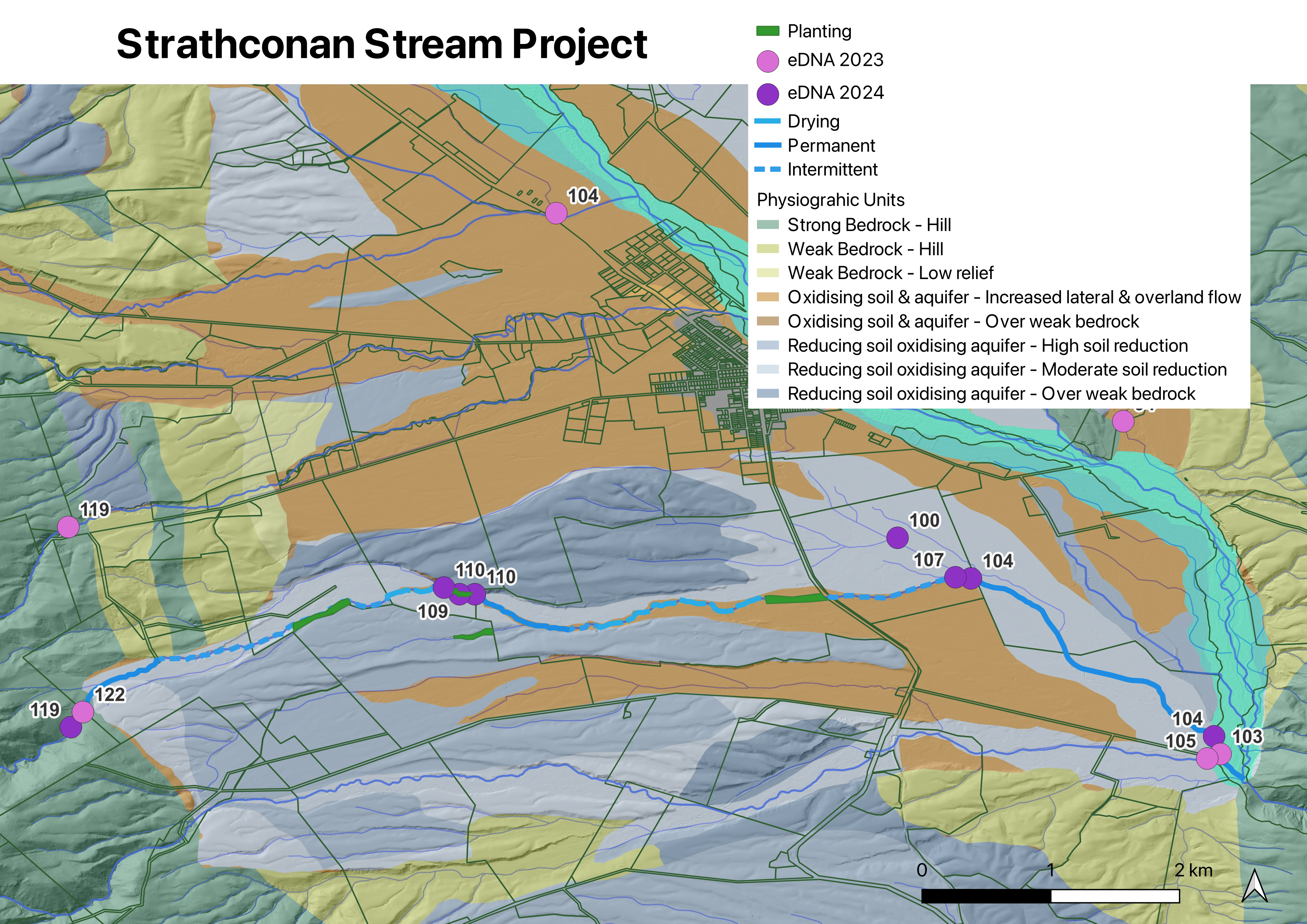

Planting on Strathconan Stream
Following the Physiographic Maps and eDNA Survey, farmers along Strathcoan Stream asked how they could Integrate this information to know where they are, and how they can move forward.
The group undertook water quality monitoring, and a stream walk from the top to the bottom using the Riparian Health Assessment to better understand the pressures on the creek and how best to move forward. This information broke everything down and gave the group a baseline so it could plan forward together rather than being reactive or everyone working away on their own.
The work found that nitrates are low along most of the stream (expected from the physiographic maps), and most of the length of stream which is practical to fence off has been. Opportunities therefore relate to continuing to suppress weed invasion, and riparian planting in areas where there is less risk of flooding.
This work and community buy-in was instrumental in the group’s successful application to the OTOP Zone Committee for funding to re-introduce native riparian habitat to the stream, and begin the process of creating a corridor of native vegetation from the foothills to the Opihi River.
Get in touch:
Ashely Biggs - Catchment Group Chair
0274573874